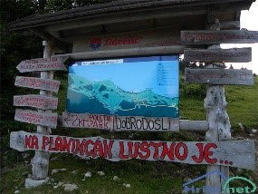
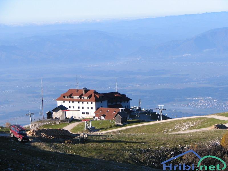
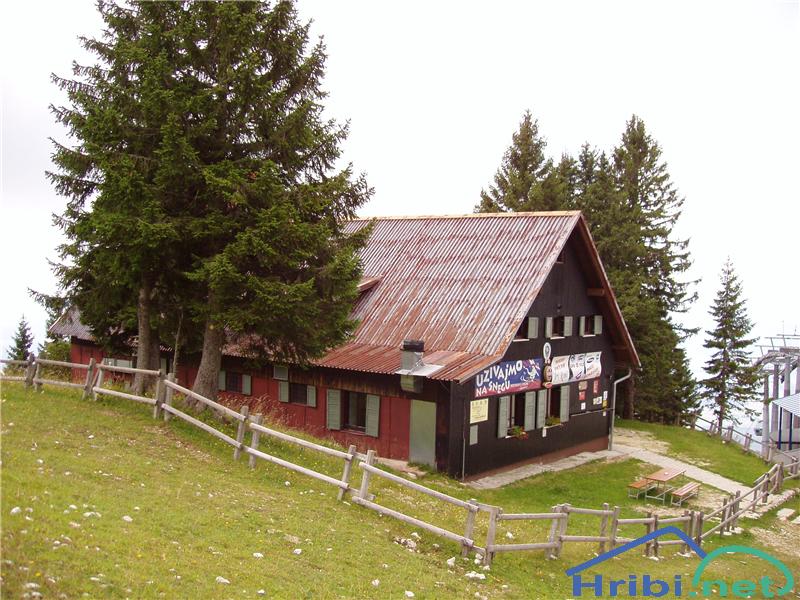
Dom na Krvavcu
Mountains: Kamnik - Savinja Alps
Latitude/longitude: 46,29964°N / 14,53663°E
Altitude: 1853 m
Description: Krvavec is a 1853 m high peak in the centre of a ski resort with the same name. From the peak, laced in ski lifts, we have a beautiful view of Gorenjska region and a part of Kamnik - Savinja Alps.
Dom na Krvavcu
PATHS
Ambrož pod Krvavcem - Dom na Krvavcu
Mountains: Kamnik - Savinja Alps
Latitude/longitude: 46,2755°N / 14,5279°E
Altitude: 1684 m
Starting point: Ambrož pod Krvavcem (1084 m)
Altitude difference: 600 m
Walking time: 1 h 45 min
Difficulty: light unmarked path
Best season for the hike: summer season
Recommended: mountain hiking footwear, hiking poles
Access to starting point: We take the highway from Ljubljana towards Gorenjska region. At the Vodice exit, we leave the highway and turn towards Vodice at the end of the exit, at the crossroads. We reach a crossroads with a traffic light (600 meters from the highway exit) and turn left for Cerklje, Brnik. We drive through the settlement Vodice and reach the settlement Spodnji Brnik, where we once again reach a crossroad (5,7 km from highway exit) and turn left in the direction of Kranj, Krvavec, then, after 100 meters right towards Cerklje, Krvavec (5,8 km from highway exit). We take this path, following the main road through Spodnji Brnik and arrive to Cerklje. In this settlement, we reach a crossroads, where we must turn towards Krvavec (9,1 km from highway exit). This takes us to the village Grad, where we must, at the end of the village, turn off the main road to the right, uphill, towards Ambrož pod Krvavcem, Šentjurška Gora (10,3 km from highway exit). We drive 2 km uphill, arriving to a crossroad, where we turn left from the main road for Ambrož pod Krvavcem, Stiška vas (12,3 km from highway exit). From this crossroad, we only drive uphill on the main road and after a good 6 kilometres we reach the tourist farm Pr' Ambružarju (18,4 km from highway exit). Here, a blue traffic board is visible, marking the parking lot, with another that has »Za goste turistične kmetije pr' Ambružar« written on it.
Path description: From the parking lot by the tourist farmstead, head back to the main road on foot, then uphill for 20 meters along the main road and turn sharply into the forest right above the parking lot. If you wish to avoid the steep ascent at the very start of the hike, continue along the asphalt uphill until you reach a sharp turn left, then onwards until you see a "crossroad" with a mountain path. Continue along this path. On it, you will see many yellow paper signs that say "Pohod". Follow them as they are a reliable guide all the way to the Jezerca peak. You will cross an asphalt road several times. On this path, you will reach the sign "Planina Jezerca", which you follow. After 10 minutes of walking, you will reach the Jezerca peak. On the peak, there is a reasonably large parking area which can accommodate over 20 vehicles, and here you will find an information board and several direction signs.
From the Jezerca peak, continue uphill and to the north. Walking along this road, you will always see the RTV Slovenia transmitter tower on top of Krvavec peak, which can be a guide to you. The mountain lodge Dom na Krvavcu is in the immediate vicinity of this tower. After approximately 20 minutes, you will reach Kriška mountain, where you will see a larger number of "tourist" houses and two ski lifts. From there, walk uphill towards the RTV transmitter tower past the far right house. You will also find a monument there with the inscription "Za svobodo padlim partizanom na krvavcu, domačinom ter prijateljem teh gora". After a few steps uphill you will once again reach a mountain trail, which will lead you towards the ski lift. Walking along it will take you under the ski lift and soon you will see the mountain lodge Dom na Krvavcu. You will need 20 minutes to get from Kriška Planina to Dom na Krvavcu.
The hike can be extended to the following destinations: Dolga Njiva mountain (Krvavec), Krvavec, Veliki Zvoh, Koren peak, Kalška gora, Kalški greben
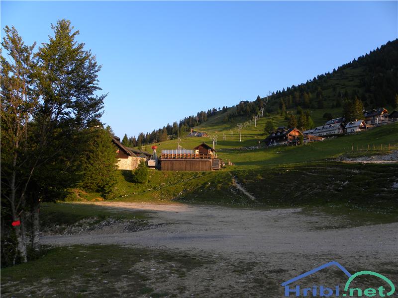
Kriška mountain - Dom na Krvavcu
Mountains: Kamnik - Savinja Alps
Latitude/longitude: 46,2929°N / 14,5369°E
Altitude: 1684 m
Starting point: Kriška mountain (1480 m)
Altitude difference: 204 m
Walking time: 35 min
Difficulty: easy marked path
Best season for the hike: summer season
Recommended: mountain hiking footwear, hiking poles
Access to starting point:
1. From the highway Ljubljana - Jesenice, take the exit Vodice then continue to the first crossroads with a traffic light in Vodice, turning left towards Cerklje na Gorenjskem and Brnik. When you reach the main roundabout in Spodnji Brnik, continue driving towards Cerklje and the Krvavec ski resort. At the end of the town of Cerklje na Gorenjskem, leave the main road which continues towards Velesovo and Visoko and continue slightly to the right towards Krvavec ski resort. Continue to the village Grad, where markings for the settlement Ambrož pod Krvavcem will direct you to the right, onto a steep asphalt road (going straight brings you to the lower station of the cable car Krvavec and Štefanja Gora). When the incline on the steep road evens out a bit, you reach the crossroads, where you continue left towards the settlement Ambrož pod Krvavcem (straight settlements Ravne, Apno and Šentruška Gora). A bit further on, the road transitionally turns into a slight descent, then climbs over slopes that occasionally offer quite a good view. Higher, we reach Ambrož pd Krvavcem, where we drive around the church of St. Ambrož and tourist farm Pr Ambružarju on the left side. From the farm, the road passes into a forest, then climbs all the way to the Jezerca peak, where you will find a large, orderly parking lot.
The road gets flatter here and turns left, then, about 500 m on, it takes us to a crossroads where we turn right towards Kriška Planina (straight on is the top station of the cable car and the mountain lodge on Gospinec). Only a short, steep climb follows and we reach the parking lot at the edge of Kriška Planina.
Recently, the road from the Jezerca peak to Kriška Planina had been closed, which extends the hike for approximately 15 minutes.
2. From the highway Jesenice - Ljubljana take the exit Kranj - vzhod then continue to drive towards Brnik, Komenda and Mengeš. When you reach the main roundabout in Spodnji Brnik, continue driving towards Cerklje and the Krvavec ski resort. At the end of the town of Cerklje na Gorenjskem, leave the main road which continues towards Velesovo and Visoko and continue slightly to the right towards Krvavec ski resort. Continue to the village Grad, where markings for the settlement Ambrož pod Krvavcem will direct you to the right, onto a steep asphalt road (going straight brings you to the lower station of the cable car Krvavec and Štefanja Gora). When the incline on the steep road evens out a bit, you reach the crossroads, where you continue left towards the settlement Ambrož pod Krvavcem (straight settlements Ravne, Apno and Šentruška Gora). A bit further on, the road transitionally turns into a slight descent, then climbs over slopes that occasionally offer quite a good view. Higher, we reach Ambrož pd Krvavcem, where we drive around the church of St. Ambrož and tourist farm Pr Ambružarju on the left side. From the farm, the road passes into a forest, then climbs all the way to the Jezerca peak, where you will find a large, orderly parking lot.
The road gets flatter here and turns left, then, about 500 m on, it takes us to a crossroads where we turn right towards Kriška Planina (straight on is the top station of the cable car and the mountain lodge on Gospinec). Only a short, steep climb follows and we reach the parking lot at the edge of Kriška Planina.
Recently, the road from the Jezerca peak to Kriška Planina had been closed, which extends the hike for approximately 15 minutes.
Path description: From the parking lot, we head to a wide dirt track which passes under the ski lift and climbs across pastures (direction Dom na Krvavcu). Moderately steep path takes us to the Dom na Krvavcu mountain lodge after a bit less than 30 minutes of walking. From there, we have a lovely view of Gorenjska.
The hike can be extended to the following destinations: Dom na Krvavcu, Dolga Njiva mountain (Krvavec), Krvavec, Veliki Zvoh, Koren peak, Kalška gora, Kalški greben
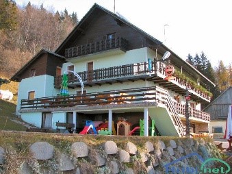
Dom na Gospincu - Dom na Krvavcu
Mountains: Kamnik - Savinja Alps
Latitude/longitude: 46,2957°N / 14,5214°E
Altitude: 1684 m
Starting point: Dom na Gospincu (1491 m)
Altitude difference: 193 m
Walking time: 35 min
Difficulty: easy marked path
Best season for the hike: summer season
Recommended: mountain hiking footwear, hiking poles
Access to starting point:
1. From the highway Ljubljana - Jesenice, take the exit Vodice then continue to the first crossroads with a traffic light in Vodice, turning left towards Cerklje na Gorenjskem and Brnik. When you reach the main roundabout in Spodnji Brnik, continue driving towards Cerklje and the Krvavec ski resort. At the end of the town of Cerklje na Gorenjskem, leave the main road which continues towards Velesovo and Visoko and continue slightly to the right towards Krvavec ski resort. We park at the large, orderly parking lot next to the bottom station of the Krvavec cable car, purchase a ticket and take the cable car to the top station which is next to the Dom na Gospincu mountain lodge.
2. From the highway Jesenice - Ljubljana take the exit Kranj - vzhod then continue to drive towards Brnik, Komenda and Mengeš. When you reach the main roundabout in Spodnji Brnik, continue driving towards Cerklje and the Krvavec ski resort. At the end of the town of Cerklje na Gorenjskem, leave the main road which continues towards Velesovo and Visoko and continue slightly to the right towards Krvavec ski resort. We park at the large, orderly parking lot next to the bottom station of the Krvavec cable car, purchase a ticket and take the cable car to the top station which is next to the Dom na Gospincu mountain lodge.
3. From the highway Ljubljana - Jesenice, take the exit Vodice then continue to the first crossroads with a traffic light in Vodice, turning left towards Cerklje na Gorenjskem and Brnik. When you reach the main roundabout in Spodnji Brnik, continue driving towards Cerklje and the Krvavec ski resort. At the end of the town of Cerklje na Gorenjskem, leave the main road which continues towards Velesovo and Visoko and continue slightly to the right towards Krvavec ski resort. Continue to the village Grad, where markings for the settlement Ambrož pod Krvavcem will direct you to the right, onto a steep asphalt road (going straight brings you to the lower station of the cable car Krvavec and Štefanja Gora). When the incline on the steep road evens out a bit, you reach the crossroads, where you continue left towards the settlement Ambrož pod Krvavcem (straight settlements Ravne, Apno and Šentruška Gora). A bit further on, the road transitionally turns into a slight descent, then climbs over slopes that occasionally offer quite a good view. Higher, we reach Ambrož pd Krvavcem, where we drive around the church of St. Ambrož and tourist farm Pr Ambružarju on the left side. From the farm, the road passes into a forest, then climbs all the way to the Jezerca peak, where you will find a large, orderly parking lot. The road gets flatter here and turns left, then, about 500 m on, it takes us to a crossroads where we turn slightly to the left towards the top station of the cable car and the mountain lodge on Gospinec (Kriška Planina to the right). We follow the gravel road for a while longer until we reach the top station of the cable car.
Recently, the road from the Jezerca peak to Dom na Gospincu had been closed, which extends the hike for approximately 30 minutes.
4. From the highway Jesenice - Ljubljana take the exit Kranj - vzhod then continue to drive towards Brnik, Komenda and Mengeš. When you reach the main roundabout in Spodnji Brnik, continue driving towards Cerklje and the Krvavec ski resort. At the end of the town of Cerklje na Gorenjskem, leave the main road which continues towards Velesovo and Visoko and continue slightly to the right towards Krvavec ski resort. Continue to the village Grad, where markings for the settlement Ambrož pod Krvavcem will direct you to the right, onto a steep asphalt road (going straight brings you to the lower station of the cable car Krvavec and Štefanja Gora). When the incline on the steep road evens out a bit, you reach the crossroads, where you continue left towards the settlement Ambrož pod Krvavcem (straight settlements Ravne, Apno and Šentruška Gora). A bit further on, the road transitionally turns into a slight descent, then climbs over slopes that occasionally offer quite a good view. Higher, we reach Ambrož pd Krvavcem, where we drive around the church of St. Ambrož and tourist farm Pr Ambružarju on the left side. From the farm, the road passes into a forest, then climbs all the way to the Jezerca peak, where you will find a large, orderly parking lot. The road gets flatter here and turns left, then, about 500 m on, it takes us to a crossroads where we turn slightly to the left towards the top station of the cable car and the mountain lodge on Gospinec (Kriška Planina to the right). We follow the gravel road for a while longer until we reach the top station of the cable car.
Recently, the road from the Jezerca peak to Dom na Gospincu had been closed, which extends the hike for approximately 30 minutes.
Path description: At the upper station of the cable car to Krvavec, we notice numerous mountaineering direction signs. We head towards the lodge Dom na Krvavcu and Marija Snežna, along a poorly visible path, which climbs along the grassy slope almost straight upwards. The poorly visible path leads us higher through the grazing fence, beyond which it becomes somewhat easier to follow. The reasonably steep path then brings us to the Dom na Krvavcu lodge, which we could already see from the upper ski lift station (we can reach it along a gravel road of lesser quality as well).
The hike can be extended to the following destinations: Dom na Krvavcu, Dolga Njiva mountain (Krvavec) (1 h), Krvavec (25 min), Veliki Zvoh (50 min), Koren peak (2 h 5 min), Kalška gora, Kalški greben
Planina Jezerca - Dom na Krvavcu
Mountains: Kamnik - Savinja Alps
Latitude/longitude: 46,2855°N / 14,5314°E
Altitude: 1684 m
Starting point: Planina Jezerca (1410 m)
Altitude difference: 274 m
Walking time: 50 min
Difficulty: easy marked path
Best season for the hike: summer season
Recommended: mountain hiking footwear, hiking poles, crampons in the winter
Access to starting point:
1. From the highway Ljubljana - Jesenice, take the exit Vodice then continue to the first crossroads with a traffic light in Vodice, turning left towards Cerklje na Gorenjskem and Brnik. When you reach the main roundabout in Spodnji Brnik, continue driving towards Cerklje and the Krvavec ski resort. At the end of the town of Cerklje na Gorenjskem, leave the main road which continues towards Velesovo and Visoko and continue slightly to the right towards Krvavec ski resort. Continue to the village Grad, where markings for the settlement Ambrož pod Krvavcem will direct you to the right, onto a steep asphalt road (going straight brings you to the lower station of the cable car Krvavec and Štefanja Gora). When the incline on the steep road evens out a bit, you reach the crossroads, where you continue left towards the settlement Ambrož pod Krvavcem (straight settlements Ravne, Apno and Šentruška Gora). A bit further on, the road transitionally turns into a slight descent, then climbs over slopes that occasionally offer quite a good view. Higher, we reach Ambrož pd Krvavcem, where we drive around the church of St. Ambrož and tourist farm Pr Ambružarju on the left side. From the farm, the road passes into a forest, then climbs all the way to the Jezerca peak, where you will find a large, orderly parking lot.
2. From the highway Jesenice - Ljubljana take the exit Kranj - vzhod then continue to drive towards Brnik, Komenda and Mengeš. When you reach the main roundabout in Spodnji Brnik, continue driving towards Cerklje and the Krvavec ski resort. At the end of the town of Cerklje na Gorenjskem, leave the main road which continues towards Velesovo and Visoko and continue slightly to the right towards Krvavec ski resort. Continue to the village Grad, where markings for the settlement Ambrož pod Krvavcem will direct you to the right, onto a steep asphalt road (going straight brings you to the lower station of the cable car Krvavec and Štefanja Gora). When the incline on the steep road evens out a bit, you reach the crossroads, where you continue left towards the settlement Ambrož pod Krvavcem (straight settlements Ravne, Apno and Šentruška Gora). A bit further on, the road transitionally turns into a slight descent, then climbs over slopes that occasionally offer quite a good view. Higher, we reach Ambrož pd Krvavcem, where we drive around the church of St. Ambrož and tourist farm Pr Ambružarju on the left side. From the farm, the road passes into a forest, then climbs all the way to the Jezerca peak, where you will find a large, orderly parking lot.
Path description: At the end of the parking lot, where the road turns left and the road towards the nearby Jezerca peak leads right, we notice red mountain direction signs, which direct us straight onto the marked footpath towards Kriška peak, Koren peak, Košutna, Kompotel and Mokrica, which climbs through the pastures of the already mentioned peak. After a shorter ascent, we reach the dirt track and follow it left, where we cross the peak Kržišča (1658 m). The dirt track which we are walking on quickly divides into two parts, we continue on the lower one. Transitionally, we see a lovely view of Kranj, Škofja Loka hills and Storžič, then the path begins to descend slightly. A few minutes of walk follow until we reach the parking lot in the lower part of Kriška mountain.
Here, the marked path towards the Koren peak continues slightly to the right while we proceed straight forward onto the other side of the valley, where we begin to climb the grassy slope towards the nearby settlement. After a shorter ascent, we reach the pasture hut Pr Florjan, which we pass along the right side. Above the pasture hut, we gradually begin to walk along a well trodden but poorly marked path, which climbs steeper along the grassy slope. Higher, we reach a poorer, partly grassy dirt track and continue to the place where it turns right. From this curve, we take a slightly less visible path, which, in a few minutes, takes us to the Dom na Krvavcu mountain lodge.
When the skiing resort is operational, walking along the part of the path which crosses the skiing tracks is forbidden.
The hike can be extended to the following destinations: Dom na Krvavcu, Dolga Njiva mountain (Krvavec), Krvavec, Veliki Zvoh, Koren peak, Kalška gora, Kalški greben