

Dolga Njiva pasture (Krvavec)
The Dolga Njiva mountain pasture (planina) lies on the extensive grazing grounds below Veliki Zvoh and Vrh Korena.
Hiking
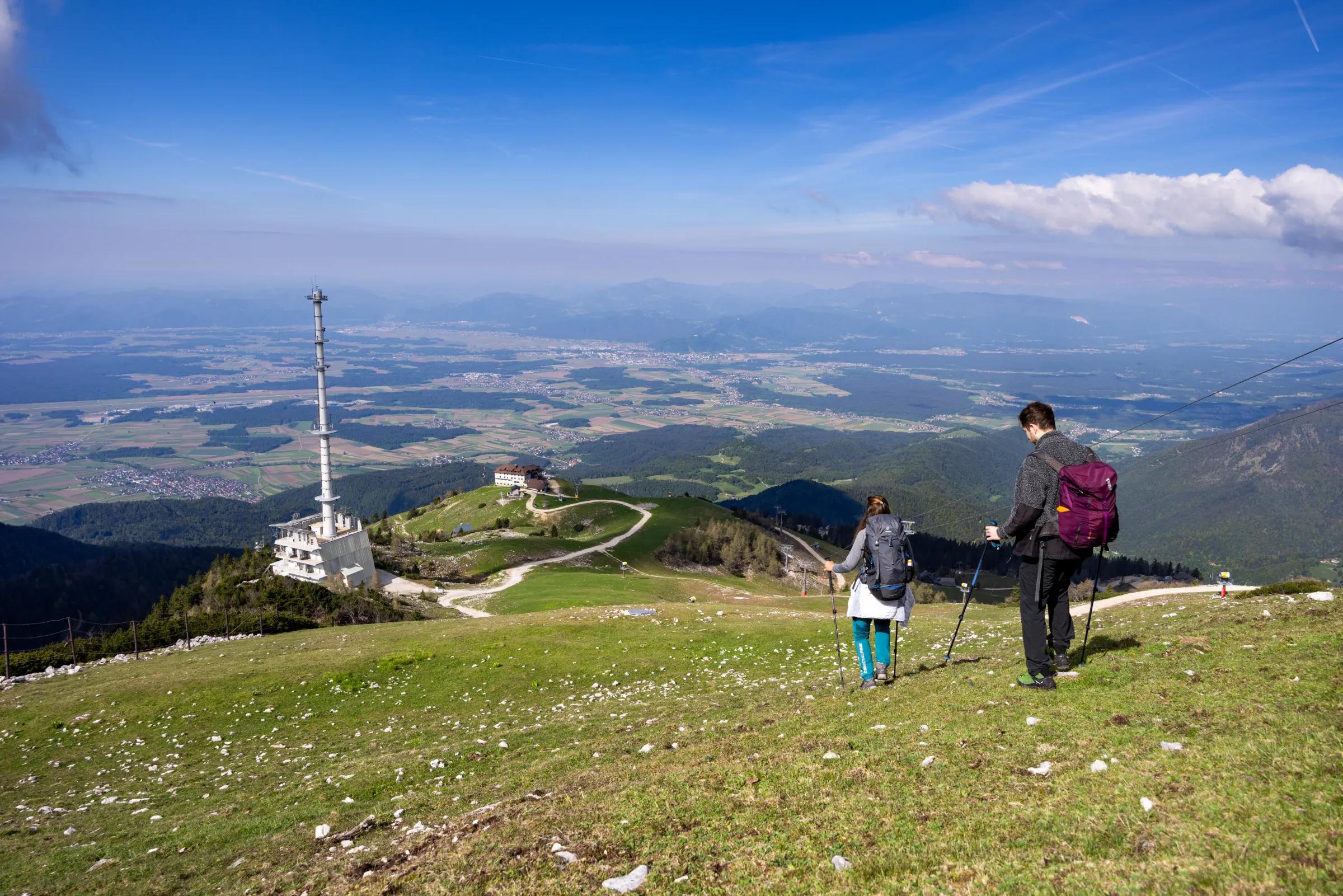
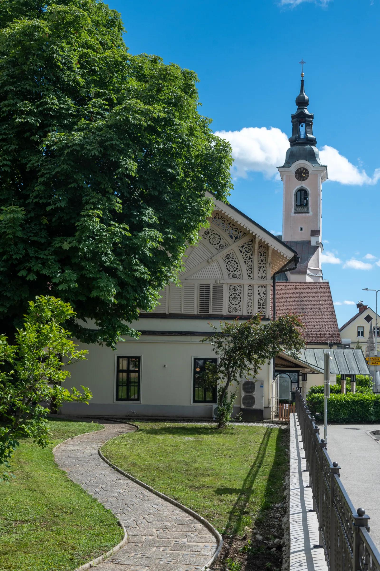
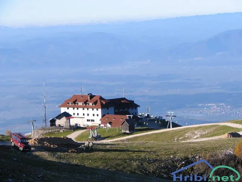
Dom na Krvavcu is a mountain hut just below the summit of Krvavec, close to the transmitter tower. Between the tower and the hut stands Plečnik’s chapel, dedicated to Our Lady of the Snows. The hut enjoys a fine view towards the Ljubljana Basin and the plain of Gorenjska (Upper Carniola). Part of the Kamnik and Savinja Alps can also be clearly seen.
Take the motorway from Ljubljana towards Gorenjska. Leave the motorway at the Vodice exit and, at the junction at the end of the slip road, turn right towards Vodice. You then reach a junction with traffic lights (600 metres from the motorway exit), where you turn left towards Cerklje and Brnik. Drive through Vodice to Spodnji Brnik, where you come to another junction (5.7 km from the motorway exit); turn left towards Kranj and Krvavec and, after 100 metres, turn right towards Cerklje and Krvavec (5.8 km from the motorway exit). Follow this main road through Spodnji Brnik to Cerklje. In Cerklje you come to another junction, where you follow the signs for Krvavec (9.1 km from the motorway exit). This brings you to the village of Grad, where at the end of the village you turn right off the main road and uphill towards Ambrož pod Krvavcem and Šenturška Gora (10.3 km from the motorway exit). Drive uphill for 2 km to a junction, where you turn left off the main road towards Ambrož pod Krvavcem and Stiška Vas (12.3 km from the motorway exit). From this junction, simply follow the main road uphill, and after a good 6 kilometres you reach the Pr' Ambružarju tourist farm (18.4 km from the motorway exit). Here you will see a blue road sign marking the car park, with the words “Za goste turistične kmetije pr' Ambružar” (For guests of the Pr' Ambružar tourist farm) beneath it.
From the car park at the tourist farm, walk back to the main road, follow it uphill for 20 metres and, directly above the car park, turn steeply into the forest. If you would rather avoid a steep climb at the very start of the hike, continue uphill along the tarmac road until you come to a sharp left-hand bend; keep following the tarmac and you will soon see a “junction” with the mountain path. Continue along this path. Along the way you will come across many yellow notes reading “Pohod” (Hike). Follow these signs, as they are reliable all the way to Jezerca pasture. You will cross the tarmac road several times. On the way you will come to a sign reading “Planina Jezerca”; follow it. After 10 minutes’ walk you will arrive at Jezerca pasture. At Jezerca pasture there is a fairly large car park with room for more than 20 cars, as well as an information board and several signposts.
From Jezerca pasture, continue uphill and northwards. As you walk along this road, you will see the RTV Slovenija tower on Krvavec ahead of you the whole time; use it as your landmark, as Dom na Krvavcu stands right next to the tower. After about 20 minutes you will reach Kriška Planina, where you will see a large number of “tourist” cottages and two lifts. From this point, head uphill towards the RTV transmitter, passing the house furthest to the right. There you will also find a monument with the inscription “Za svobodo padlim partizanom na krvavcu, domačinom ter prijateljem teh gora” (To the Partisans who fell for freedom on Krvavec, to the local people and to the friends of these mountains). A few steps further uphill you will come to the mountain path again, which will lead you in the direction of the lift. Following it, you will pass beneath the lift and soon see Dom na Krvavcu. It takes 20 minutes to walk from Kriška Planina to Dom na Krvavcu.
You can extend the hike to the following destinations: Dolga Njiva pasture (Krvavec), Krvavec, Veliki Zvoh, Vrh Korena, Kalška Gora, Kalški Greben
1. From the Ljubljana–Jesenice motorway, take the Vodice exit, then continue to the first junction with traffic lights in Vodice, where you turn left towards Cerklje na Gorenjskem and Brnik.
2. From the Jesenice–Ljubljana motorway, take the Kranj vzhod (Kranj East) exit, then continue towards Brnik.
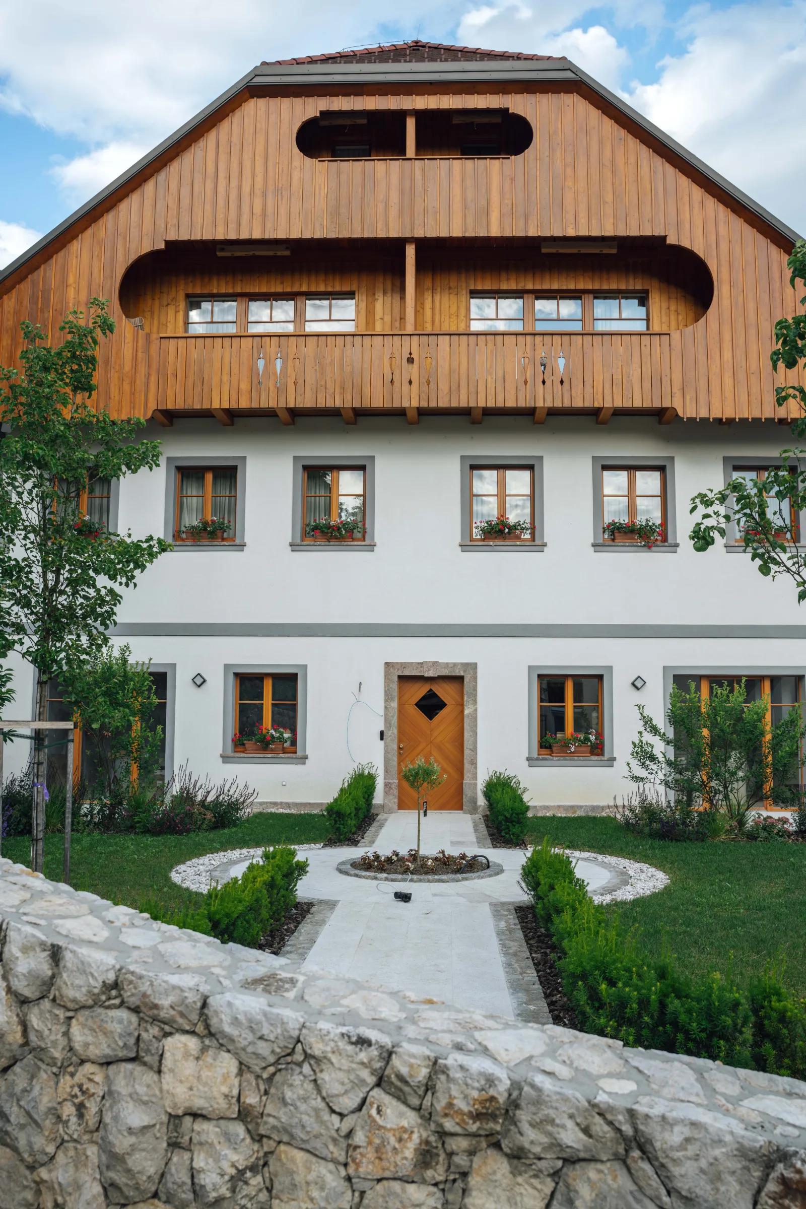
When you reach the main roundabout in Spodnji Brnik, continue towards Cerklje and the Krvavec ski resort. At the end of Cerklje na Gorenjskem, leave the main road, which continues towards Velesovo and Visoko, and bear slightly right towards the Krvavec ski resort. In the village of Grad, turn right onto a steep tarmac road towards Ambrož pod Krvavcem. Where the gradient eases slightly, continue left at the junction towards Ambrož pod Krvavcem. Higher up you reach Ambrož pod Krvavcem, where you drive past St Ambrose’s Church and the Pr' Ambružarju tourist farm. From the tourist farm, the road climbs through the forest to Jezerca pasture, where there is a large, well-kept car park.
The road from Jezerca pasture to Kriška Planina is closed to public traffic, so continue on foot from Jezerca pasture to the starting point at Kriška Planina. This adds about 15 minutes to the walk.
From the car park, head onto a wide cart track that passes under the lift and starts climbing across the pastures (signposted Dom na Krvavcu). After just under 30 minutes’ walk, the moderately steep path brings you to Dom na Krvavcu, which offers a fine view towards Gorenjska. You can extend the hike to the following destinations: Dom na Krvavcu, Dolga Njiva pasture (Krvavec), Krvavec, Veliki Zvoh, Vrh Korena, Kalška Gora, Kalški Greben
1. From the Ljubljana–Jesenice motorway, take the Vodice exit, then continue to the first junction with traffic lights in Vodice, where you continue left towards Cerklje na Gorenjskem and Brnik.
2. From the Jesenice–Ljubljana motorway, take the Kranj vzhod (Kranj East) exit, then continue towards Brnik, Komenda and Mengeš.
When you reach the main roundabout in Spodnji Brnik, continue towards Cerklje and the Krvavec ski resort. At the end of Cerklje na Gorenjskem, leave the main road, which continues towards Velesovo and Visoko, and bear slightly right onto the road towards the Krvavec ski resort. Park in the large, well-kept car park by the Krvavec cable car valley station, buy a ticket and take the gondola cable car up to the top station, which stands next to the Dom na Gospincu mountain hut.
3. From the Ljubljana–Jesenice motorway, take the Vodice exit, then drive on to the first set of traffic lights in Vodice, where you turn left towards Cerklje na Gorenjskem and Brnik.
4. From the Jesenice–Ljubljana motorway, take the Kranj vzhod (Kranj East) exit, then drive on towards Brnik, Komenda and Mengeš.
When you reach the main roundabout at Spodnji Brnik, continue towards Cerklje and the Krvavec ski resort. At the end of Cerklje na Gorenjskem, leave the main road, which continues towards Velesovo and Visoko, and bear slightly right onto the road towards the Krvavec ski resort. You then come to the village of Grad, where signs for Ambrož pod Krvavcem direct you right onto a steep asphalt road (straight on are the valley station of the Krvavec cable car and Štefanja Gora). Where the gradient of the steep road eases a little, you reach a junction; continue left towards Ambrož pod Krvavcem (straight on are the villages of Ravne, Apno and Šenturška Gora). A little further on, the road briefly drops slightly, then climbs across slopes that at times offer quite fine views. Higher up you reach Ambrož pod Krvavcem, where you skirt St Ambrose’s Church and the Pr Ambružarju tourist farm on the left-hand side. Beyond the tourist farm, the road enters the forest and climbs through it all the way to Jezerca pasture, where there is a large, well-maintained car park.
The road from Jezerca pasture to Dom na Gospincu is closed to public traffic, so park at Jezerca pasture and continue to Dom na Gospincu on foot. The walk takes about 30 minutes.
1. From the Ljubljana–Jesenice motorway, take the Vodice exit, then drive on to the first set of traffic lights in Vodice, where you turn left towards Cerklje na Gorenjskem and Brnik.
2. From the Jesenice–Ljubljana motorway, take the Kranj vzhod (Kranj East) exit, then drive on towards Brnik, Komenda and Mengeš.
When you reach the main roundabout at Spodnji Brnik, continue towards Cerklje and the Krvavec ski resort. At the end of Cerklje na Gorenjskem, leave the main road, which continues towards Velesovo and Visoko, and bear slightly right onto the road towards the Krvavec ski resort. You then come to the village of Grad, where signs for Ambrož pod Krvavcem direct you right onto a steep asphalt road (straight on are the valley station of the Krvavec cable car and Štefanja Gora). Where the gradient of the steep road eases a little, you reach a junction; continue left towards Ambrož pod Krvavcem (straight on are the villages of Ravne, Apno and Šenturška Gora). A little further on, the road briefly drops slightly, then climbs across slopes that at times offer quite fine views. Higher up you reach Ambrož pod Krvavcem, where you skirt St Ambrose’s Church and the Pr Ambružarju tourist farm on the left-hand side. Beyond the tourist farm, the road enters the forest and climbs through it all the way to Jezerca pasture, where there is a large, well-maintained car park.
At the end of the car park, where the road bends to the left and a road towards the nearby Jezerca pasture branches off to the right, you will see red mountain signposts directing you straight ahead onto the marked footpath towards Kriška Planina, Vrh Korena, Košutna, Kompotela and Mokrica, which climbs across the meadows of Jezerca pasture. After a short climb you reach a cart track; follow it to the left as it crosses the slopes of Kržišče (1,658 m). The track soon forks; continue straight ahead on the lower branch. For a while a fine view opens up towards Kranj, the Škofja Loka Hills and Storžič, then the path begins to descend gently. A few more minutes’ walking brings you to the car park at the lower end of Kriška Planina.
Here the marked path to Koren pasture continues slightly to the right, but you continue straight ahead to the other side of the valley, where you begin to climb the grassy slope towards a nearby cluster of buildings. After a short climb you reach the Pr’ Florjan dairy hut (planšarija); pass it on the right. Above the dairy hut, gradually join a well-trodden but poorly waymarked path that starts to climb more steeply up the grassy slope. Higher up you reach a rougher, partly grassy cart track; follow it uphill to the point where it turns right. From this bend, continue straight ahead on a somewhat less distinct path, which brings you up to Dom na Krvavcu in a few minutes.
While the ski resort is operating, walking on the section of the route that crosses the ski piste is prohibited.
You can extend the walk to the following destinations: Dolga Njiva pasture (Krvavec), Krvavec, Veliki Zvoh, Vrh Korena, Kalška Gora, Kalški Greben.
Ambrož pod Krvavcem – Dom na Krvavcu – starting point Ambrož pod Krvavcem (1,084 m), walking time 1 h 45 min, ascent 600 m, difficulty: easy unmarked path. Kriška Planina – Dom na Krvavcu – starting point Kriška Planina (1,480 m), walking time 35 min, ascent 204 m, difficulty: easy marked trail. Dom na Gospincu – Dom na Krvavcu – starting point Dom na Gospincu (1,491 m), walking time 35 min, ascent 193 m, difficulty: easy marked trail. Jezerca pasture – Dom na Krvavcu – starting point Jezerca pasture (1,410 m), walking time 50 min, ascent 274 m, difficulty: easy marked trail.
Best time for the hike: summer season.
Source: https://www.hribi.net/izlet/ambroz_pod_krvavcem_dom_na_krvavcu/3/179/1345
Source: hribi.net
The Dolga Njiva mountain pasture (planina) lies on the extensive grazing grounds below Veliki Zvoh and Vrh Korena.
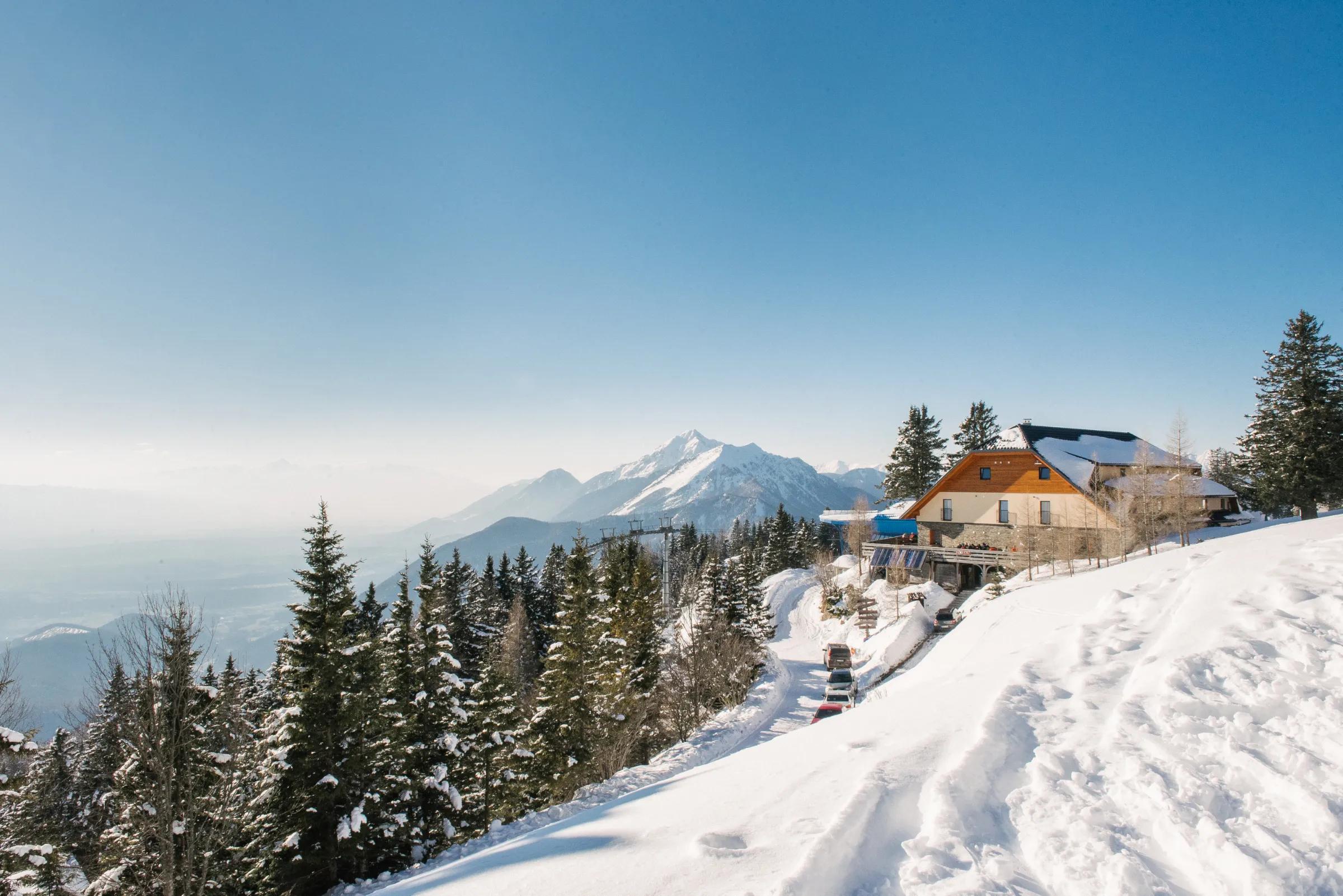
Dom na Gospincu / Hotel Rozka stands right next to the upper station of the Krvavec cable car. The hut offers a fine view of the slopes of the Krvavec ski area and part of the Kamnik–Savinja Alps.
Koren pasture is still a working mountain pasture (planina), lying between Veliki Zvoh and Košutna.